
Land Surveying & Subdivision Services
Protect your property investment with accurate ground-truth surveying and end-to-end subdivision permitting. Guided by Licensed Geodetic Engineers, we handle the entire process—from physical boundary striking to LGU clearances, agency approvals, and final title issuance.

Land Surveying & Subdivision Services
We help make the most of your property by getting the boundaries right and keeping land development on track, from the first site survey through to the final title release.
Our Approach to Land Surveying

Accurate survey information is an important starting point for any property development, purchase, or investment. Knowing exactly where a property begins and ends can help prevent boundary problems, delays, and issues during the approval process.
Nieuwland provides land surveying and subdivision services from the initial site assessment through to the preparation of plans and final documentation. We bring together on-site surveying, careful document checking, and an understanding of local requirements to help property owners, developers, and investors make informed decisions about their land.
Our Approach to Land Surveying
Accurate survey information is an important starting point for any property development, purchase, or investment. Knowing exactly where a property begins and ends can help prevent boundary problems, delays, and issues during the approval process.
Nieuwland provides land surveying and subdivision services from the initial site assessment through to the preparation of plans and final documentation. We bring together on-site surveying, careful document checking, and an understanding of local requirements to help property owners, developers, and investors make informed decisions about their land.
Our Approach to Land Surveying
A missed boundary or a title error isn’t just an oversight—it’s a council rejection, a delayed settlement, or a costly dispute with a neighbor. Every successful build, purchase, and subdivision starts with getting the ground truth right.
At Nieuwland, we handle your land surveying from the first trip into the field through to final plan lodgement. We pair precision on-site mapping with deep title checking, giving you clear, compliant plans that move through local approvals without friction.
Whether you’re dividing a single residential lot or structuring a multi-phase development, we give you the exact facts you need to build and invest with confidence.
Need expert guidance on your land layout or planning requirements?
Our Core Services
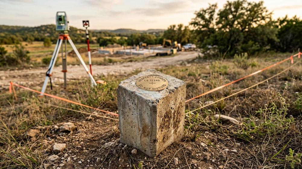
A. Boundary & Relocation Surveys
A boundary and relocation survey physically re-establishes and marks your legal property lines on the ground. Guided by a Licensed Geodetic Engineer, we use the technical descriptions from your land title (OCT/TCT) and official survey records to map out exact corners, set official concrete markers (mohon), and protect your investment against boundary errors.
Property Line & Monument Staking: Precise on-site mapping and installation of standard concrete survey pegs to define your true legal boundaries.
Encroachment & Overlap Checks: Early detection of structural encroachments, fence line overlaps, unrecorded easements, and access conflicts before they stall sales or trigger legal disputes.
Title & Document Verification: Cross-referencing physical site conditions against your title’s technical descriptions and historical survey plans to expose and resolve discrepancies early.
Requirements to Begin:
Copy of the Land Title (Transfer Certificate of Title / Original Certificate of Title) or Tax Declaration.
Official technical description of the lot.
Previously approved survey or subdivision plans (if available).

B. Topographic & Site Surveys
This service maps the exact physical layout and terrain of your property. Guided by a Licensed Geodetic Engineer, we capture precise ground elevations, contours, natural features, and existing infrastructure—providing the critical spatial data architects and civil engineers need to design safely, plan drainage, and secure local building permits.
Contour & Elevation Mapping: Detailed recording of ground slopes, spot heights, and terrain changes to support excavation, grading, and structural foundation design.
Feature & Utility Location: Precise mapping of existing structures, pavements, power poles, drainage lines, and visible utility infrastructure across the site.
Natural Feature & Boundary Alignment: Documenting trees, waterways, and natural terrain variations while referencing established property lines for seamless project integration.
Common Applications:
Architectural design, engineering layouts, and site development planning.
Stormwater drainage planning, site grading, and earthwork calculations.
Local government building permit submissions and regulatory compliance.
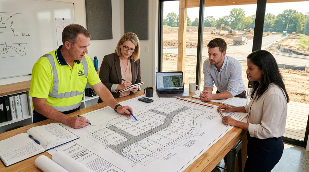
C. Land Subdivision Planning & Approval
Dividing or combining land requires navigating both physical site planning and strict legal approvals. Guided by a Licensed Geodetic Engineer, we manage the complete subdivision process—from initial lot layout and surveying to coordinating with local government units (LGUs) and national agencies to secure individual titles for each parcel.
Preliminary Survey & Feasibility: On-site boundary mapping, terrain evaluation, and schematic lot layouts drafted in compliance with local municipal zoning ordinances.
LGU & Permitting Support: Coordinating locational clearances, barangay resolutions, and municipal development permits under national housing and design standards (eg, BP 220 / PD 957).
Agency Clearances & Final Titling: Navigating DENR environmental clearances (ECC/CNC), DAR conversion requirements, and LRA plan verifications to issue separate Transfer Certificates of Title (TCTs) through the Registry of Deeds.
Key Approval Stages We Handle:
LGU Locational Clearances, Development Permits, and Barangay Resolutions.
National Agency clearances via DENR, DAR, and DHSUD (License to Sell registration).
Final technical plan verification with the Land Registration Authority (LRA) and Registry of Deeds.

D. Construction Staking & As-Built Surveys
Construction staking and as-built surveys provide the critical start-to-finish quality control for any building or infrastructure project. Guided by a Licensed Geodetic Engineer, we translate approved engineering plans into precise physical markers on-site, then map completed structures to verify that construction matches official codes and approved blueprints.
Construction & Grid Line Staking: Physical placement of control points, grid nails, offset hubs, and grade stakes to guide excavation, foundations, utility placement, and building corners accurately.
Structural & Alignment Verification: Real-time field checks during construction to prevent costly layout errors, maintain setback compliance, and guide contractors according to approved plans.
As-Built Mapping & Documentation: Final GPS and total station mapping of finished structures, paved surfaces, and utility lines to produce certified as-built plans for project handover, permits, and future facility management.
Core Construction Stages Supported:
Pre-construction layout (grid lines, foundation footings, property line setbacks, and site grading).
In-progress verification (column alignment, utility depth checks, and structural elevation checks).
Post-construction sign-off (certified as-built survey plans for local government clearance and title updates).
Planning to build, acquire, or subdivide property?
How We Work
Every property is different, but our general process follows a straightforward approach:
Step 1
Document & Title Review
We analyze your land title (OCT/TCT), tax declarations, deeds, and historical survey plans to identify existing boundaries, technical descriptions, and potential legal or record discrepancies.
Step 2
On-Site Survey & Mapping
Our field team deploys to the property using high-precision equipment to measure boundaries, trace ground elevations, locate existing utilities, and check for structural encroachments.
Step 3
Plan Drafting & Technical Verification
We process field data against registry records to draft compliant boundary, topographic, or subdivision plans certified by a Licensed Geodetic Engineer.
Step 4
Regulatory Submission & Clearances
We coordinate the necessary plan verifications and submissions across local government units (LGUs) and national authorities—including the LRA, DENR, DAR, or DHSUD where required.
Step 5
Final Marking & Document Delivery
Property Developers: Seeking optimized lot layouts, infrastructure mapping, and complete subdivision permitting (LRA, DENR, DHSUD) to launch projects on time.
Who We Serve
Property Developers: Seeking optimized lot layouts, infrastructure mapping, and complete subdivision permitting (LRA, DENR, DHSUD) to launch projects on time.
Institutional & Private Investors: Requiring pre-acquisition due diligence, ground-truth boundary verification, and title validation to mitigate legal risk before closing.
Commercial Real Estate Owners: Managing estate consolidations, commercial expansions, utility mapping, or easement updates across active properties.
Individual & Family Landowners: Resolving boundary line disputes, subdividing inherited family estates (extrajudicial settlements), or preparing land for sale with clear, updated titles.
Frequently Asked Questions
How long does a land subdivision take?
The timeframe depends on the size and location of the property, the condition of the existing documents, the complexity of the subdivision, and the processing time of the relevant government offices. The actual site survey may take considerably less time than the full approval and titling process, which can take several months or longer in some cases.
Why should I conduct a relocation survey before acquiring a property?
A title only tells you what is on paper—a relocation survey proves what exists on the ground. Guided by a Licensed Geodetic Engineer, it verifies true boundary lines, checks for structural encroachments or fence overlaps, and ensures the technical description on the OCT/TCT matches physical site reality before money changes hands.
Is a boundary survey mandatory before subdividing land?
Yes. You cannot draft an approved subdivision plan without first establishing the exact physical boundaries, area, and ground conditions of the mother lot. The initial survey forms the legal and technical baseline for drawing new lot lines, access roads, and utility easements under national design standards (e.g., BP 220 / PD 957).
Can a land survey resolve an ongoing boundary dispute with a neighbour?
A relocation survey physically re-establishes property lines on the ground based on official title descriptions and registered survey records, marking them with concrete monuments ( mohon ). While an engineer’s certified survey plan provides definitive technical evidence of encroachment, formal legal disputes or boundary litigation may also require coordination with country legal counsel.
Not sure which survey type your property project needs? Ask Our Land Survey Specialists Directly →
Ready to Get Started?
Speak with Nieuwland about your property, surveying requirements, or subdivision plans. We can review your needs and help you understand the next steps.